
InfraWorks for analysis and simulation
Explore your infrastructure designs with built-in analysis and simulation tools
Features of InfraWorks for analysis and simulation
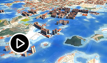
Flood simulation
Visualize and analyze 2D flood simulations in your model to optimize inland and coastal flooding projects depending on the parameters you define. (video: 11 sec.)
Watershed analysis
Identify and analyze watersheds intersecting a component road or from a single low point in the terrain.

Traffic simulation
Analyze traffic flow through intersections, display color-coded traffic analyses, and generate traffic simulation animations to play in your model. (video: 17 sec.)

Mobility simulation
Use integrated multi-modal mobility tools to create animated simulations of transit, parking, personal, and/or taxi-mode modeling. (video: 21 sec.)

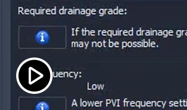
Alignment and profile optimization
Optimize cost and environmental impacts of your roadway designs by evaluating parameters such as design speed, grading, cross-slopes, and PVI frequency and spacing. (video: 19 sec.)
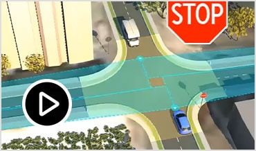
Line-of-sight analysis
Conduct line-of-sight studies to visualize the impact of designs from specific project locations. Analyze intersections to identify sight failure zones. (video: 17 sec.)
Line girder analysis
Perform analysis and design checks on all the pre-stressed girders of your concrete bridges to verify the structural strength of bridge girders and experiment with multiple bridge designs.


“3D allows you to ensure design intent in the final form.”
—Arnold Ledan, Civil Engineer, Egis JMI