
InfraWorks for context modeling
Aggregate volumes of data to generate a real-world context model of your project
Features of InfraWorks for context modeling
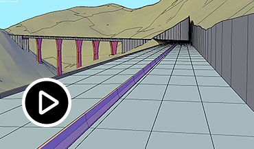
Reality capture
Generate more accurate context models. Create clean terrain surfaces, capture existing conditions like roads and bridges, and extract linear features from point clouds. (video: 29 sec.)

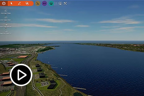
GIS integration
Streamline design and GIS data exchange with Esri ArcGIS. Establish a rich context model and ensure teams maintain access to up-to-date project information. (video: 23 sec.)

3D objects
Establish more realistic base models by importing 3D models from 3ds Max, Revit, or Civil 3D. Stylize other objects in the model by bringing the 3D models into your style catalogs.

Revit model integration
Generate a view of a Revit model that is geolocated in InfraWorks. Analyze and present Revit models within the broader context of the project’s existing conditions.

Design corridor
Configure InfraWorks road models to use calculated corridor geometry and alignments from Civil 3D, then map InfraWorks materials to Civil 3D corridor shapes and linkages. (video: 8 sec.)
“We’re starting to come up with a more secure, federated location for our project data.”
—Chuck Pietra, Senior Technical Operations Manager, OBG