
Key features of Civil 3D
Site and survey workflows
Download, create, analyze, and adjust survey data, as well as transfer field-captured data to the office
Terrain modeling
Create digital models of topography for land-use studies, transportation system planning, and water flow simulations
Corridor modeling
Create dynamic and data-rich corridor models for highways, roads, and rail tracks
Intersection design
Create dynamic models of 3-way (T-shaped) or 4-way intersections, as well as roundabouts
Drainage design and analysis
Manage stormwater and sanitary sewer design. Define pipeline paths, optimized with hydraulics/hydrology analysis
Pressure networks
Lay out horizontal and vertical pressure network designs; model deflected-curve pipe segments and use design and depth checks
Plan production and documentation
Quickly create construction documents from drawings, including plan/profile, plan(s)-only, profile(s)-only, and section sheets
Interoperability
Civil 3D supports import, export, and links with commonly used CAD formats, including IFC, and connects with Esri ArcGIS and Bentley data
Design automation
Use visual programming to generate scripts that automate repetitive and complex tasks, including electrification and signaling
Geotechnical modeling
Visualize and analyze subsurface data and easily utilize that data directly in the Civil 3D design model
Materials and quantities
Use materials and sectional or profile information to create reports for volumes, comparing design and existing surfaces and quantity takeoff
Bridge design
Coordinate workflows more efficiently across the various disciplines working on complex bridge design projects
More features of Civil 3D
Surface modeling tools
Create surfaces composed of a combination of points, breaklines, boundaries, and contours with support for TIN, Grid, and Cropped, and Corridor surfaces.
Point cloud tools
Use a large collection of points acquired by laser scanners and other capture technologies to create digital representations of existing conditions and structures. Import the point data to Civil 3D to generate a 3D model to be used in your design project.
Surface editing
Work with editing tools that add edits to a surface definition as edit operations and not to any of the existing surface data components.
Surface masks
A display tool that enables you to block out areas of a surface and prevent them from being displayed or to render a section of the surface using a specified render material.
Surface watersheds
Analyze how water flows along and off a surface to better determine drain targets and watersheds.
Surface volumes
Use the Volumes Dashboard to calculate and analyze volume surfaces and bounded areas within those surfaces.
Surface analysis
Conduct surface-related analysis, including contour, directions, elevations, slopes, slope-arrows, watersheds, and water drop path.
Site design tools
Manage objects (parcels, alignments, gradings, and feature lines) with a common topology in a site collection.
Survey tools
Streamline the download, creation, analysis, and adjustments of field-captured survey data.
Field-to-finish workflow
More efficiently process field-captured survey data to create an intelligent base map in Civil 3D.
Geotechnical modeling
Visualize and analyze geotechnical data then use that data directly in the Civil 3D design model.
Grading tools
Grading tools and commands facilitate the efficient design of finished ground surfaces.
Grading optimization
Automate the process for conducting grading design studies for land areas based on established design project criteria.
NEW
Subassembly deployment
and management
Deploy both subassemblies and assemblies more efficiently by sharing a custom subassembly in a shared project location. Corridors consuming the subassembly can be easily updated to use the new version.
ENHANCED
Corridor transitions
Create and edit corridor transition when you want to transition a parameter in a subassembly from one value to another. More controls have been added to allow easy movement of transitions and rearranging the order of transitions.
Corridor design tools
Create dynamic and data-rich corridor models for highways and roads. Build rail track corridor models, incorporating designs for switches, turnouts, and cant calculations.
Export corridor data
Extract corridor feature lines with ease to use as a basis for creating grading objects or other design projects. Extracting feature lines can be done all at once, selected one-by-one, or by selecting a subset within a corridor region or a polygon.
Assemblies and subassemblies
Efficiently use assemblies and subassemblies to establish the basic building blocks of a roadway or other alignment-based design.
Intersections and roundabouts
Create dynamic 3-way, 4-way, or roundabout intersections.
Advanced roundabout design
Model roundabouts according to defined standards. Build your roundabouts into existing corridor models, enabling your design to update automatically when you make changes to the corridor alignments.
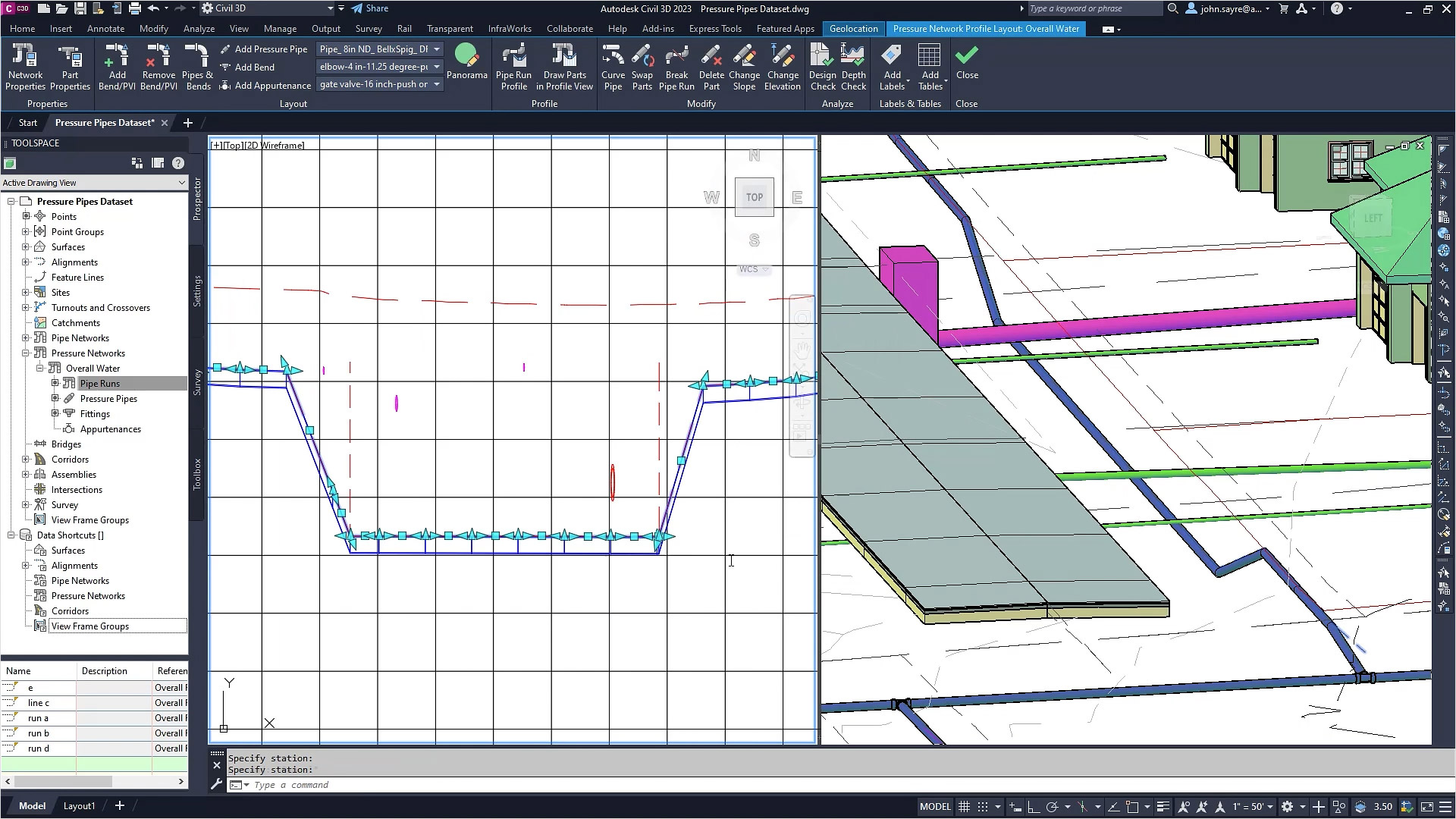
ENHANCED
Pressure network design
Generate 3D models of pressure networks, such as water transmission systems. More controls have been added for layout and editing workflows including merging pressure networks, DREF sync improvements, and party symbol display.
Modeling pipe networks
Efficiently draw 2D and 3D models of utility systems, such as storm sewers, sanitary sewers, and more.
Hydraulics and hydrology tools
Perform a variety of stormwater management tasks, including storm sewer design, watershed analysis, detention pond modeling, and culvert, channel, and inlet analysis.
Pressure network design
Generate 3D models of pressure networks, such as water transmission systems. More controls have been added for layout and editing workflows including merging pressure networks, DREF sync improvements, and party symbol display.
Plan production and construction documentation
Create plan-only, plan and profile, profile-only, and section sheets by including multiple plan or profile views on a single sheet.
QTO and earthwork calculations
Extract and report material volumes and analyze quantities from materials and sectional or profile information.
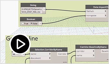
Dynamo for Civil 3D
Use the Dynamo visual scripting environment to develop routines that automate repetitive design tasks and expedite workflows. (video: 1:16 min.)
ENHANCED
Project Explorer
Manage the staggering volume of design data in Civil 3D models in this tool. Easily review, validate, report, export and edit models. Enhancements have been made to the navigation capabilities and tools to make management and reporting of custom property data more efficient.
Corridor data shortcut (DREF)
Create and share data shortcuts for corridors.
3ds Max interoperability
Create professional-quality visualizations.
IFC import and export
Import and export AutoCAD solids to IFC files.
Exchange data with InfraWorks
Bring context modeling and conceptual design into your design process. Make better decisions with a real-world context of existing conditions, more efficiently consider alternatives, and complete detailed design and documentation in Civil 3D.