Civil 3D for site design
Create comprehensive, accurate site designs
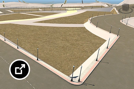
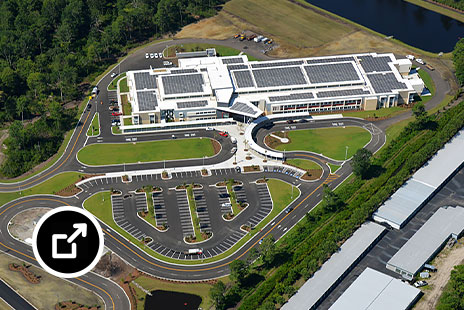
Prepare and shape ground surfaces for roadway, buildings, subdivision, and other civil infrastructure projects.
Civil 3D features for site design
Survey
Download, create, analyze, and adjust survey data. Streamline the transfer of field-captured data to and from the office. (video: 11 sec.)
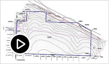
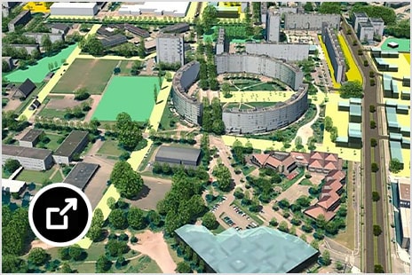
Terrain modeling
Create comprehensive digital models of ground topography for studies such as land-use feasibility, transportation system planning, and water flow simulations. (video: 14 sec.)
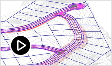
Corridor modeling
Create dynamic and data-rich corridor models for designs such as residential roads, curbs, and sidewalks, swales within a subdivision, and parking lot design. (video: 10 sec.)
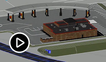
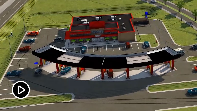
Vehicle tracking
Use swept path analysis to speed planning and evaluate safety standards compliance. Animate vehicle paths with 2D or 3D animations using multiple camera angles. (video: 20 sec.)
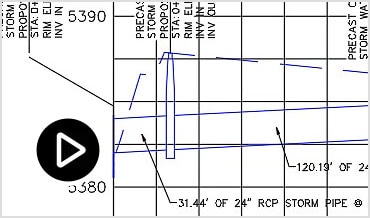
Stormwater and sanitary sewer
Model storm and sanitary sewer systems. Analyze networks to resize pipes, reset inverts, and compute energy and hydraulic grade lines according to HEC-22 standards.
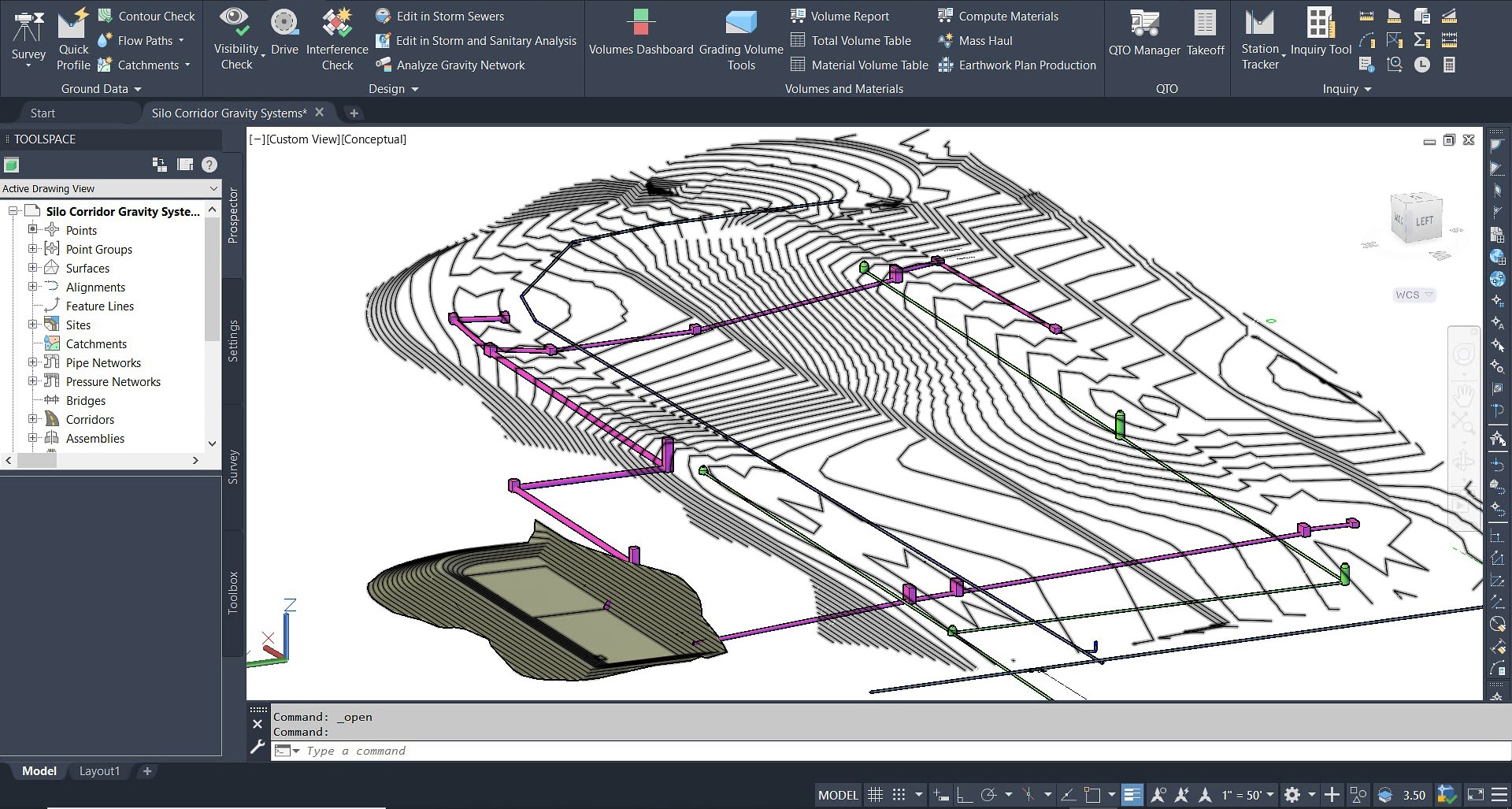
Stormwater analysis
Integrate stormwater and wastewater analysis during planning and design of urban drainage systems, storm sewers, and sanitary sewers. (video: 39 sec.)
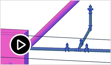
Pressurized utilities
Lay out horizontal and vertical 3D design of pressure networks. Model deflected-curve pipe segments and use design and depth checks to meet project standards. (video: 11 sec.)
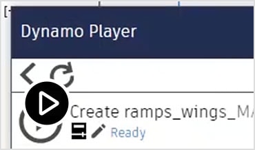
Design automation
Use a visual programming application to generate scripts that automate repetitive and complex tasks. Save these scripts in a library and reuse them as needed. (video: 1:49 min.)
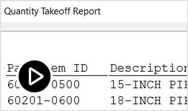
Materials and quantities
Use materials and sectional or profile information to create reports for volumes along an alignment, comparing design and existing ground surfaces, and quantity takeoff. (video: 13 sec.)
Connect other Autodesk products for site design
Accelerate site layout, grading, and drainage
Quickly layout site design in Civil 3D based on rich context information from InfraWorks and ReCap Pro. (video 1:49 min.)
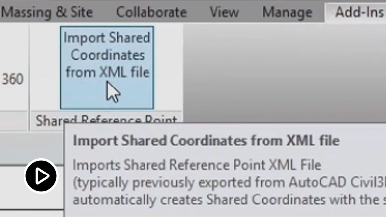
Improve site and building coordination
Improve coordination between architects and civil engineers with shared coordinate systems. (video 1:59 min.)
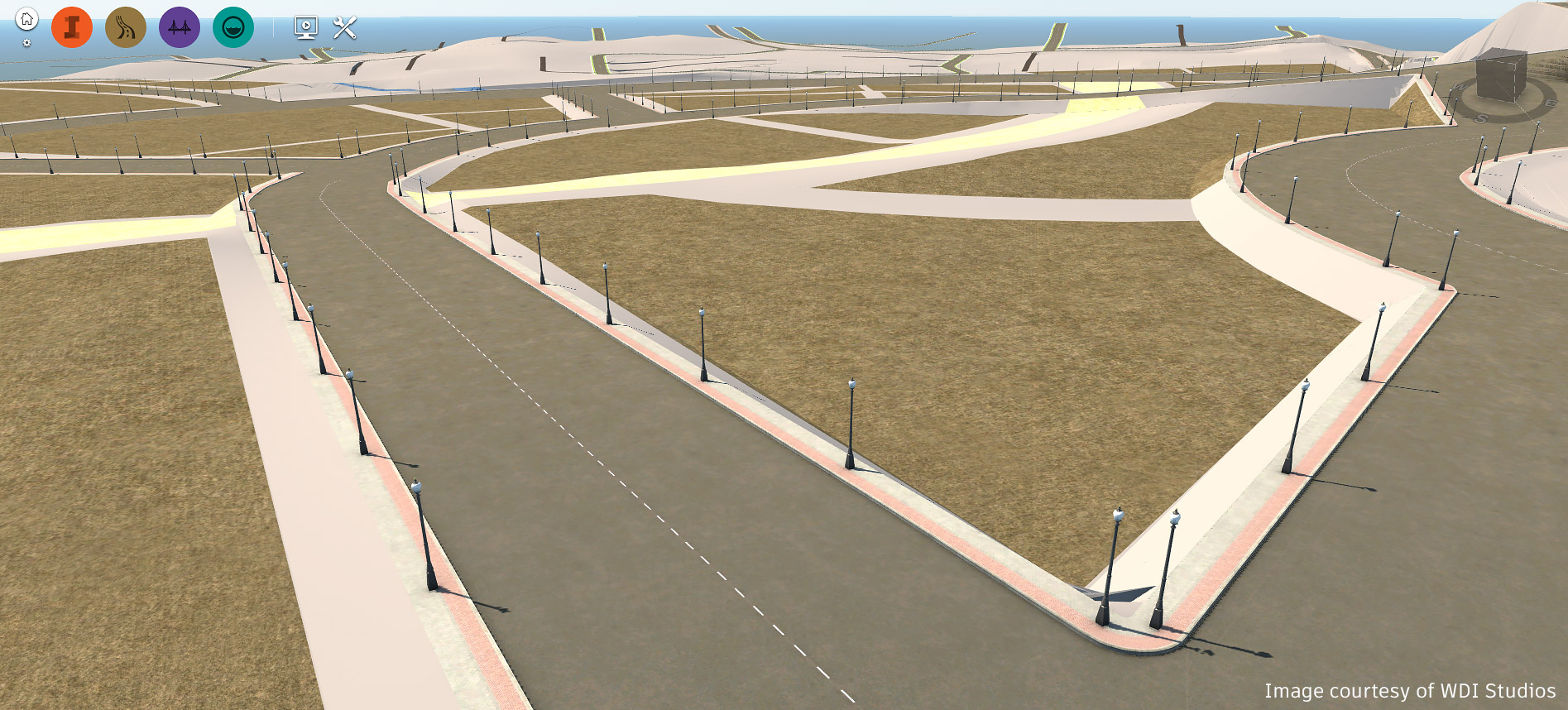
“Determining current … improved cut-and-fill conditions would have taken days if computed manually.”
—Gaurav Sharma, Director of Technology, WDI Studios
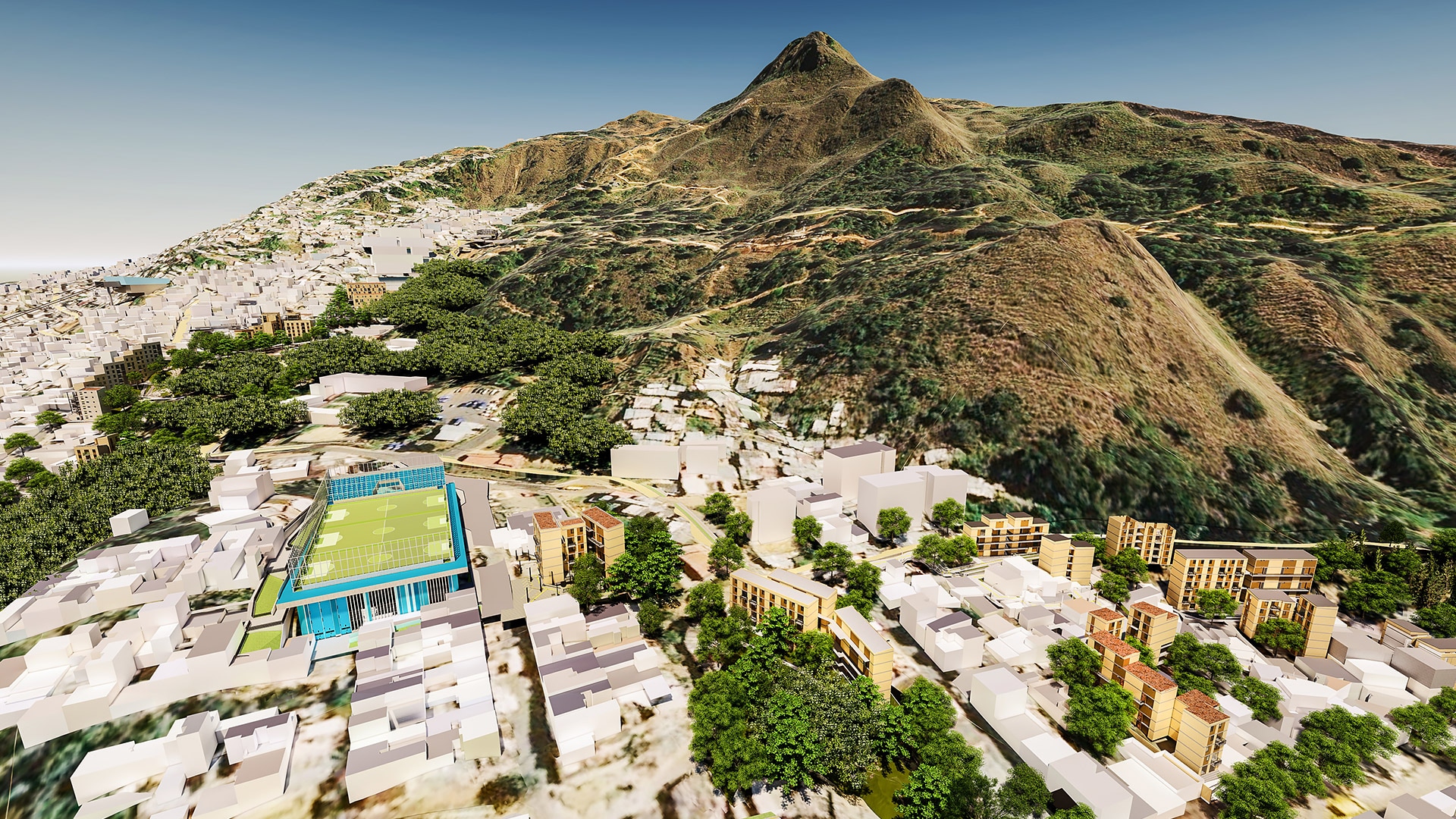
“We use these tools to save money and time. They help us envision problems, which ultimately benefit these projects and the communities.”
—Paula Palacios, Secretary of Physical Infrastructure, Medellín
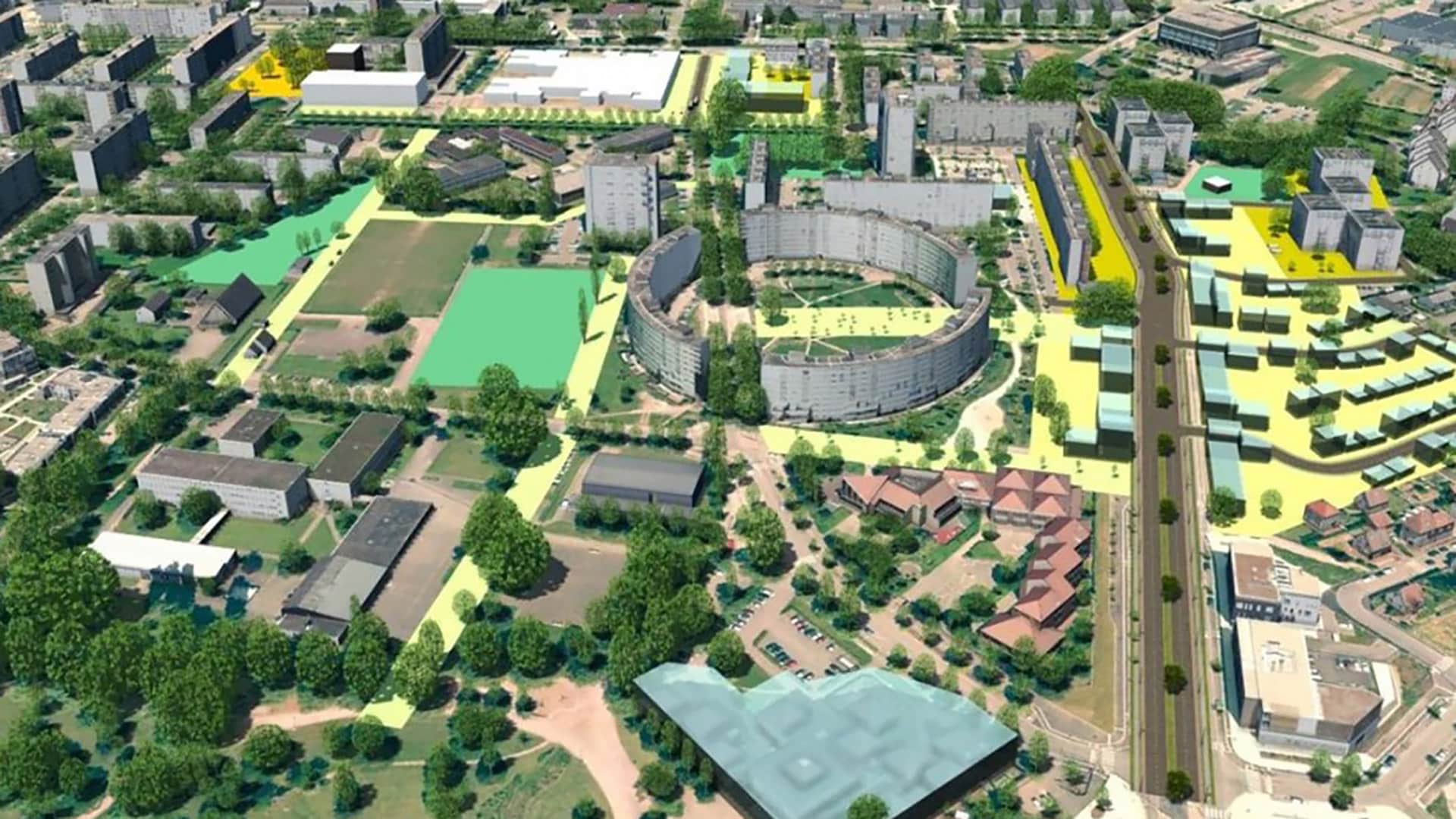
“3D and BIM are there to make people think differently about how to design and manage their projects.”
—Philippe Slisse, 3D GIS Project Manager, City and Eurometropolis of Strasbourg
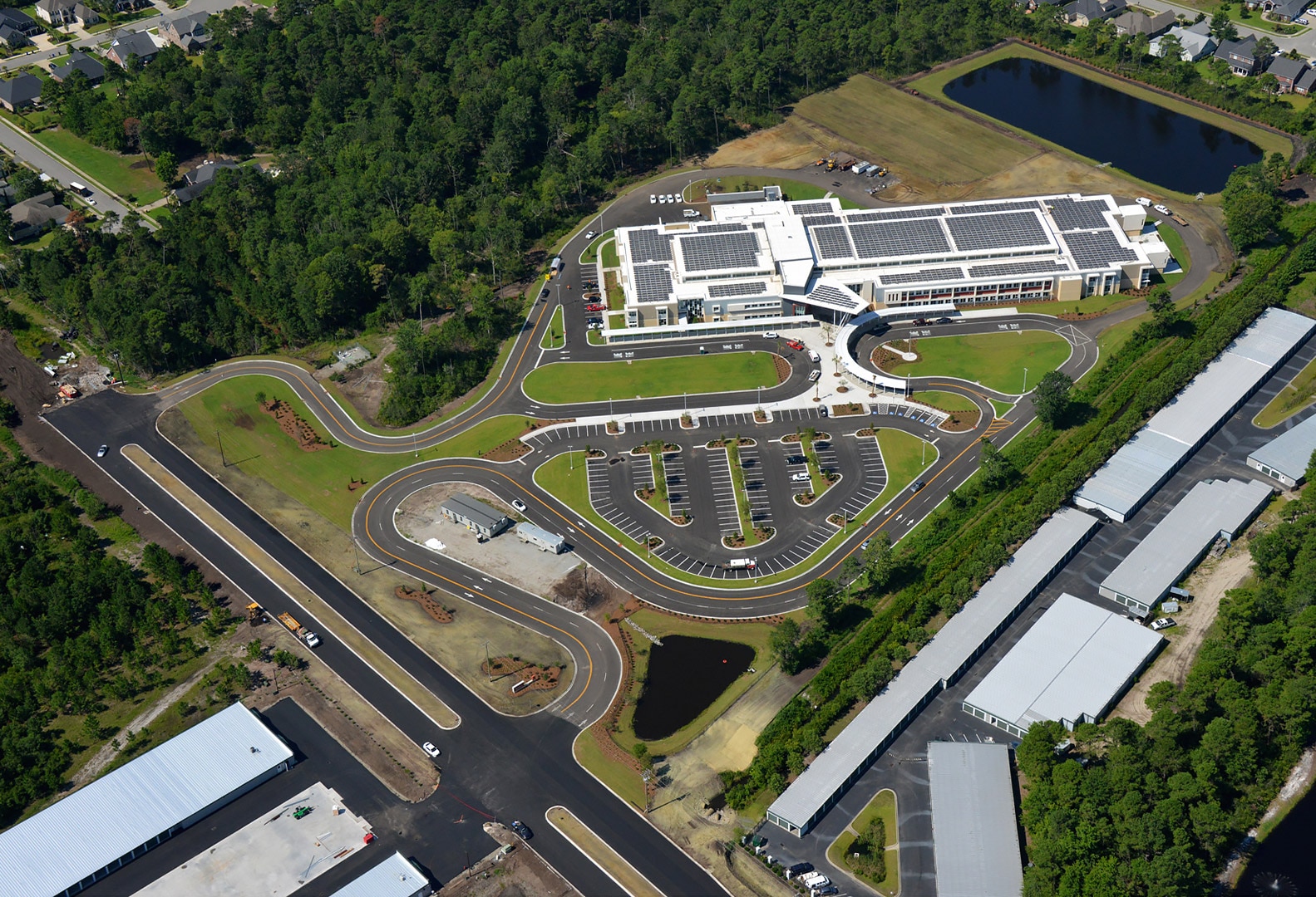
“Civil 3D allowed for quick generation of plans for signature and submittal to agencies.”
—Charles D’Errico, IT Systems Analyst, Thomas & Hutton